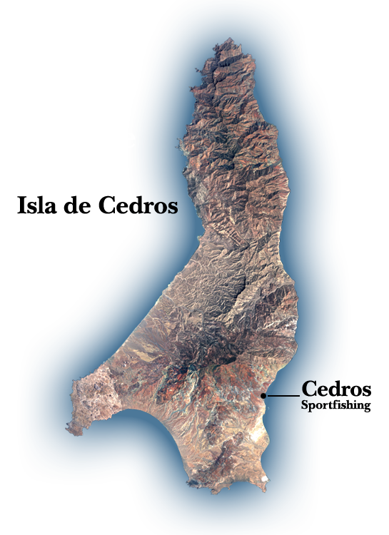
Cedros Island (Isla de Cedros, "island of cedars" in Spanish) is a Mexican island in the Pacific Ocean. Cedros Island is located approximately 310 miles south from San Diego, CA, in the Ensenada Municipality, off the west coast of the Mexican state of Baja California. It is 13.5 miles northwest of Punta Eugenia in the Mulegé Municipality, the westernmost point of the state of Baja California Sur mainland. It also lies 9.25 miles north of Isla Natividad. The island has an area of 134.477 square miles and is the fourth-largest island in Mexico.
Cedros Island is approximately 24 miles long in N-S direction and approximately 4 to 5 miles wide in the northern half; the southern end is 11 miles wide in a NW-SE direction. The island consists of a variety of sedimentary, metamorphic, and igneous rocks, including part of an ophiolite complex and high-pressure, low temperature blueschists. Most of the rocks are of Mesozoic age, though some late Cenozoic strata crop out near the town in the southeastern corner of the island. Its highest peak, Monte Cedros, has an elevation of 3,949 feet.
Between Cedros Island and Isla Natividad runs the 28th parallel north, which defines the border between the Mexican states of Baja California and Baja California Sur.
Cedros Island is one of the 24 subdivisions (delegaciones) of the municipio of Ensenada. The 2005 census showed a total population of 1,350 persons.
Cedros town ("Pueblo Cedros"), is the main town and is located on the southern east coast. Pueblo Cedros is largely associated with Pescadores Nacionales de Abulón, the lobster and abalone fishing cooperative based on the island. Fishermen founded the town in 1922.
The second town is Puerto Morro Redondo (in short, El Morro), close to the southeastern point of the island, El Morro. It is a "company town," built by the joint Mexican Government and Mitsubishi Corporation to house the workers of the salt-transshipment facility on the island. Salt from the salt evaporation ponds of Guerrero Negro on the Baja California peninsula is taken by barge to a deepwater salt dock near Puerto Morro Redondo, at the south end of Cedros Island, where it is loaded onto ships for export.
The remaining settlements are smaller. Jerusalem is just west of El Morro, but on the western side of the airport, with regularly arranged residential units. It is frequently considered part of El Morro.
Lomas Blancas, a mining town with 17 buildings, is located between Cedros town and El Morro.
San Agustín, a typical fishing village with about 20 buildings, is located approximately 1 mile northeast of the southwestern point of the island, Cabo San Agustín.
La Colorada, on the southern west coast, with about 10 buildings, is approximately 2 miles north of San Agustín. Wayle, 15 buildings on the western side of the southern bight Bahía del Sur, is approximately 2 miles northeast of San Agustín.
The mining town of Punta Norte (about 25 buildings) is located on the northern east coast, approximately 2 miles southeast of the northern end of the island, which is also called Punta Norte. Two km to the southeast is Los Crestones mine.


